 |
Ladakh Trekking Tours :: Ladakh Places to See
Ladakh Places to See
Leh
Leh is the headquarter of Leh District, and the largest town of the region. It is located to the north of the Indus River at an elevation of 3600m above the sea level. The town is dominated by the nine-storey Namgyal Palace and Namgyal Tsemo (victory peak), built by Tashi Namgyal on his victorious in reunification of the Upper and Lower Ladakh. Leh became the capital of Stod (upper Ladakh) during the reign of king Graspa Bum- Lde,who ruled Ladakh from 1400 to 1430 AD. In the later period, Leh became an important center for trade in Central Asia. Leh remained merely a headquarter of Ladakh district until 1974, when Ladakh was opened for foreign tourists. Since then period Leh became the centre for tourism related activities in the region.
Kargil
Kargil, the headquarter of Kargil district, is around 204 Kms. to the east of Srinagar and 234 Kms. to the west of Leh.It was a transit point of caravans on their way to and from China, Tibet, Yarken and Kashmir till 1949, but since 1974 tourism has replaced as centre for tourism related activities . Torurists travelling between Zangskar, Leh and Srinagar have to make a night halt here, before starting for the second day of their journey.
Kargil is located on the bank of the Suru River which flows at around 10,000 ft. high. Here people were followers of Buddhist religion till the 14th century AD. Presently, Kargil is inhabited by Muslims of Shia sect.
Zanskar
Zangskar valley lies to the south west of Leh, surrounded by the Himalayan and Zangskar ranges, which is the most isolated of all the trans- Himalayan valleys.
Zangskar comprises of two main valleys of Stod (Doda chu) and Lunak (Tsarab chu), which converge below at Padum. The valley has an area of about 5,000 sqr. Kms. and an elevation of 13,154 ft. The area remains inaccessible for nearly 7 months in the year. All the high passes are close in the winter and the river freeze on the surface. Zanskaris walk along the frozon river to reach the Indus River in Nimoo village, which is known as the Chadar trek.
Nubra valley
The Nubra Valley means Ldumra (the valley of flowers), situated in the north of Leh. The average altitude of the valley is about 10,000 ft. above the sea level. The main attraction in this area is Bactarian Camels (Shaggy double hump Camel) around sand dunes, Deskit & Samstanling monasteries and Khardung la Pass (18,380 feet.) above sea level. This Tour can be organized for 3 days 2 nights.
Getting There: The road journey to Nubra valley leads through Khardongla (the highest motor able road in the world) 18380 ft. around 50 kms. away from Leh. After crossing the pass, you can have a view of Khardong village, Khalser and Deskit (the main villages of Nubra valley). The Deskit village offers Guest Houses and lower budget hotels. The Camel safari can be organized from Deskit to Hunder village for 2 hours. Hundar village has small monastery and it is located on ancient Silk Route.
Chang thang - The land of Nomads
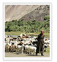
Changthang means Eastern Flat land, is located in the east of Leh on the Chinese border. The average altitude of the area is around 14600m above sea level. This area is also known as Rupsho valley. The main attraction of this area is Changpa nomads, wild animals, Lakes and rare birds.
Tomoriri Lake
The Tsomoriri Lake is a beautiful mountain bounded expanse of water, around 240 Kms. from Leh in Rupsho Valley. The Lake is located at 14,000 ft. near a small village of Korzok. The Korzok Monastery of 19th century houses Shakyamuni Buddha and other statues. The Nomadic people are most outstanding feature of this Lake area, which grazed herd of goats and yaks. The Tsokar (the salt Lake) around 76 kms. from Tsomoriri is also a wonderful Lake in this area.
Trip to these two Lakes can be organised in two or three days by Jeep and two weeks or three weeks trek.
Pangong Lake
Pangong is 40 miles in length and nearly 2-4 miles in width at a height of 4267m above the sea level What strikes the eye in coming first in view of this lake is the lovely colour of its water, espacially towards evening, which is of the richest deep blue, over the whole expanse, at morning time, it is of a lighter a very brilliant colour. The water of the Lake is not that salty as sea water.
Pangong Tso trip can be organised in two days and overnight stay at Tangtse.Travellers are not allowed to pitch their tents near the Lake and only allowed to go upto Spangmik due to security reason. As 75% of the Lake is in China and only 25% is in India.The landscape on the way to Pangong is spectacular.
Dhahanu - The land of Aryans
Dhahanu is situated to the south west of Leh, around 163 Kms. passing through the beautiful villages of Kaltsey, Domkhar, Skurbuchan and Achinathang. There are many small villages but only two villages of Dha and Hanu are open for tourist. Being on lower altitude Dhahanu is warmer than Leh.
Attraction :
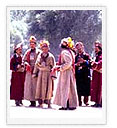
The main attraction of this tour is Drokpa Community considered being as last race of Aryans confined to the valley. Their feature is pure Indo Aryan and they have preserved their racial purity down the Centuries. Their culture and religious practices are very similar to ancient pre- Buddhist religion known as Bon-Chos. This tour can be done in two days.
|
